Skip to main content
Main navigation
Collections
Organizations
Exhibits
About
Home
Geography & Maps
Browse All Topics
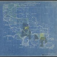
Emporium Forestry Company Maps
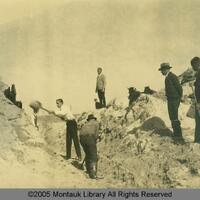
Montauk Land Use and Development
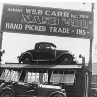
Watervliet Businesses
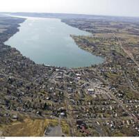
Aerial Photography of New York State
Stereograph Card Collection of Geneva
Polster Photographs of Lockport, NY
Huntington Legal Manuscripts
Buffalo Photograph Collection: Lantern slides, circa 1890-1910
A Birds Eye View of Cayuga County
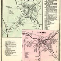
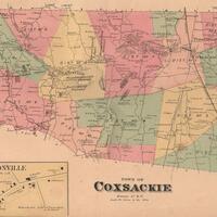
Western New York County Atlases
Heermance Memorial Library Digital Collection
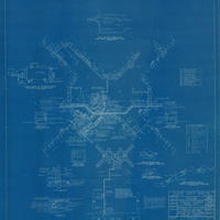
Pilgrim State Hospital Blueprint Collection
State Reservation at Niagara
Map Collection
Holland Land Company Maps
Seneca Ray Stoddard Adirondack Stereoviews
See more