Skip to main content
Main navigation
Collections
Organizations
Exhibits
About
Home
Geography & Maps
Browse All Topics
History of the Town of Amherst, New York, 1818-1965
Miner Institute Blueprints and Maps Collection
New York to Paris Race
1825, a Pivotal Year on the Niagara Frontier
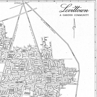
Historic Maps of Levittown
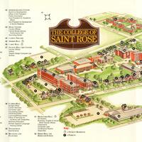
The College of Saint Rose Archives - Map Collection
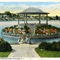
Onondaga Parks Association
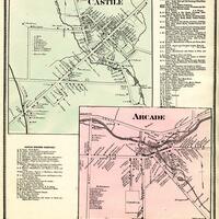
Western New York County Atlases
Water Mill Business Association
Buffalo Postcards
Madison County Atlases
Stereograph Card Collection of Geneva
Rochester Public Library Local History Division Map Collection
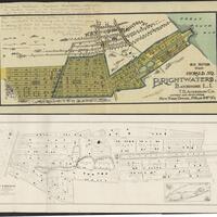
Brightwaters Community Maps and Early Advertisements
State Reservation at Niagara
Watervliet Businesses
See more