Collections
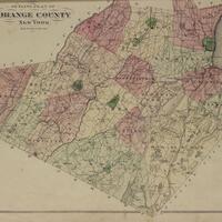
This collection includes the F.W. Beers County Atlas of Orange County (1875) and the A.H. Muller Atlas of Orange County (1903).
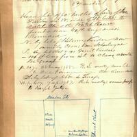
The Pearson Street Books consist of four volumes of notes and sketched maps created by Jonathan Pearson, city historian, about property ownership in the city of Schenectady, New York from the 1660s through the mid-nineteenth century.
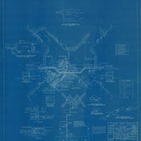
Blueprints used in the construction of Pilgrim State Hospital in the 1930’s.
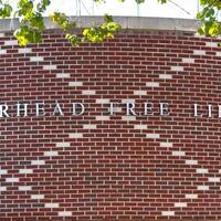
Literature and images relating to the history of the Riverhead Free Library
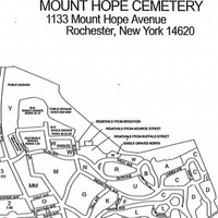
Burial location records and maps for Mount Hope Cemetery in Rochester, New York from the 19th century through to the mid-20th century.
This collection contains regional maps dating from 1827 to the 1980’s. Both individual maps and bound maps, such as plat maps, are included.
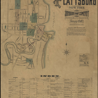
1902 Sanborn Map Company Insurance Map of Plattsburg, Clinton County, New York.

This collection includes documents, images, and ephemera relating to the hamlet of Tappan.
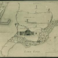
Photographs, letters, maps, drawings, and documents relating to the War of 1812.
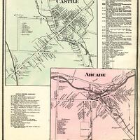
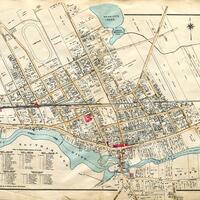
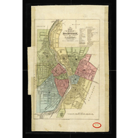
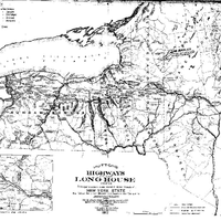
A collection of maps detailing the Western New York region in the mid-to-late 19th century.