Collections
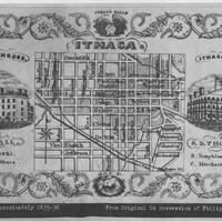
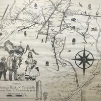
Maps, including Clock System maps, depicting the city of Ithaca and greater Tompkins County.
A collection of 20 digitized reels of microfilmed primary source materials relating to the history and early years of the Holland Land Company, with a focus on materials detailing the history and development of Western New York.
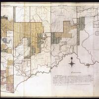
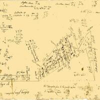
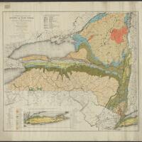
A collection of late 18th century and early 19th century maps, particularly of Western New York and Pennsylvania, created for the Holland Land Company.
Historical maps showing land purchases and boundaries in the Town of Huntington.

Original, historic maps that tell the story of Irvington and reflect the change and evolution in the wider community.
Photographs, maps, and postcards documenting the history of Jericho, NY.

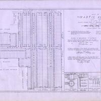
Photographs, maps, and postcards documenting the history of Mastic Beach, NY.
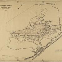
Oversized maps related to the Town of Tuxedo and Orange County.
This set of images shows buildings on Main Street in Catskill, NY that are no longer standing.
This collection of maps comes from the MacIntyre Iron Company, which operated at the Tahawus mines near Newcomb, NY.

An atlas of Madison County, New York published by Alexander Pomeroy in 1875.
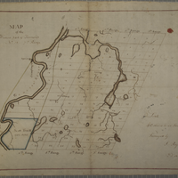
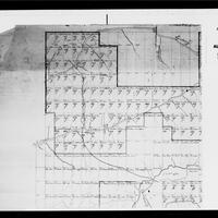
The maps (and, for some, associated documents) in this digital collection represent a portion of the 300+ in the physical Wadsworth collection and cover areas within townships, tracts, and counties in the Genesee Valley region.
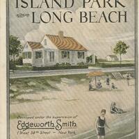
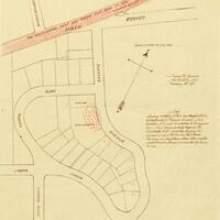
Maps of Island Park and early advertisements for homes in Island Park.
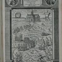
The Medieval and Early Modern Studies Collection includes manuscript leaves, manuscripts, printed book leaves, and books produced mainly in Europe from about 1200 to 1837.
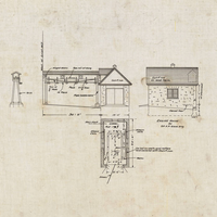
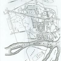
Heart's Delight Farm in Chazy, New York was a state-of-the-art farm in the early 20th century. This collection includes blueprints and maps depicting the farm and its buildings.
Historical maps from Mastic, Mastic Beach, Shirley, Brookhaven, and Moriches communities on Long Island
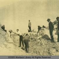
Historic photographs and maps showing land development in Montauk.
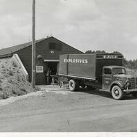
The New York Ordnance Works Collection consists of photographs, maps, and official documents related to the New York Ordnance Works (NYOW), which was in active production during World War II.
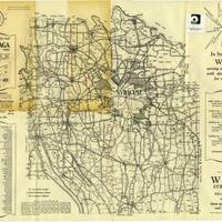
A rural directory for locating farms and agricultural property in Onondaga County and a 1938 Map of Onondaga County.
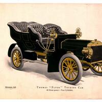
Materials relating to Thomas Flyer automobiles and the New York to Paris Race in the early 20th century.
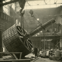
The Niagara Falls Hydraulic Power and Manufacturing Company was the first company to generate hydroelectric power from Niagara Falls in 1882. This collection includes photographs and maps which detail the construction, use, and collapse of this historically important power station.
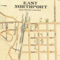
Historical maps of the Northport-East Northport community.